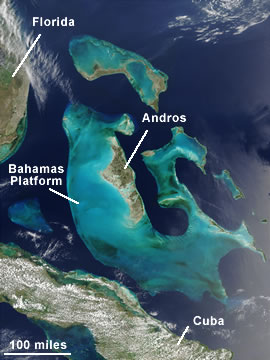
At hgttp://geology.com/nasa/great-bahamas-bank/ …. there is a NASA image of the Great Bahama Bank as seen from space. It stretches from near the N American land mass to the south, almost reaching Cuba. The image was taken by the MODIS instrument, a spectroradiometer, from a satellite and picks out beautifully the Bahamas Bank system (see below) which is just 33 feet average depth as opposed to its surrounding waters, or deep water channels, that are thousands of feet deep.

