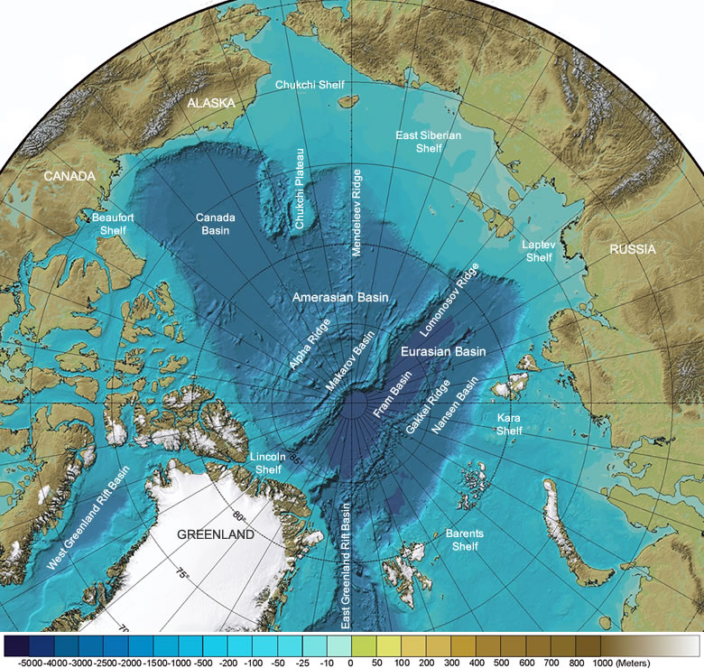
At http://geology.com/articles/arctic-ocean-features/ …
 a picture of the Arctic Ocean sea floor showing basins and ridges etc. How would it have looked when sea levels differed during the last Ice Age – and the Bering Straits were dry land. How much else of the area was above sea level?
