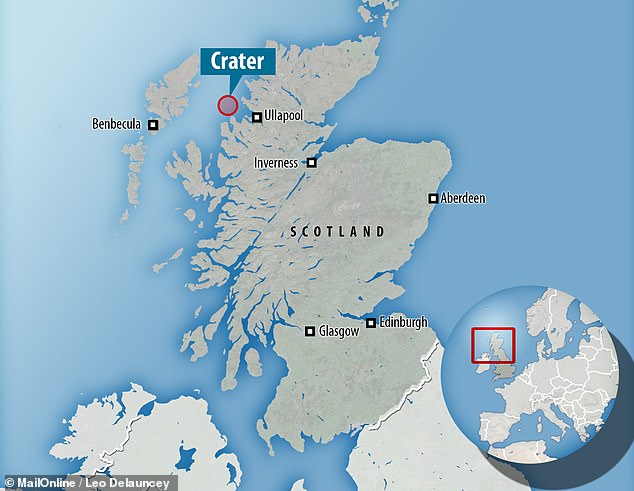
At https://tallbloke.wordpress.com/2019/06/10/site-of-biggest-ever-meteorit… … some time ago geologists came across evidence of an archaic impact event in NW Scotland but where the crater was situated eluded them. Not now it seems they have found it – 15 to 20km west off a remote part of the Scottish mainland, buried beneath both water and younger rocks, in the Minch Basin.
 … It is said to have landed in a rift valley where fresh sediments quickly buried the debris and preserved it (or that is the hope as it is now open to excavation, if possible in deep water). Looking at the map above we can see the Minch Basin is between the mainland and the Isle of Lewis, and that raises an interesting question. How old is the rift valley and what role did the formation of the rift, or the impact come to that, have on the topography. For example, the Hebrides were at one time joined to the mainland in one continuous slab of continent. Even today they are situated on a continental shelf system which is all part of a contiguous land mass. However, whilst the Torridon Mountains rise up on the mainland (on one side of the rift) the land on the other side is much lower (on Lewis for example). Is this evidence of a slip fault along the rift? How did the impact affect this? – and so on.
The impactor is estimated to have been 1km across – not so much a meteorite but a big lump of rock. It is date to 1.2 billion years ago – again, an estimate and one based on geochronological parameters. Perhaps the age came from the initial evidence of the impact debris which was announced a year or so ago (and reported on the News).
See also www.dailymail.co.uk/sciencetech/article-7123401/ … which has more to say on the general theme.
